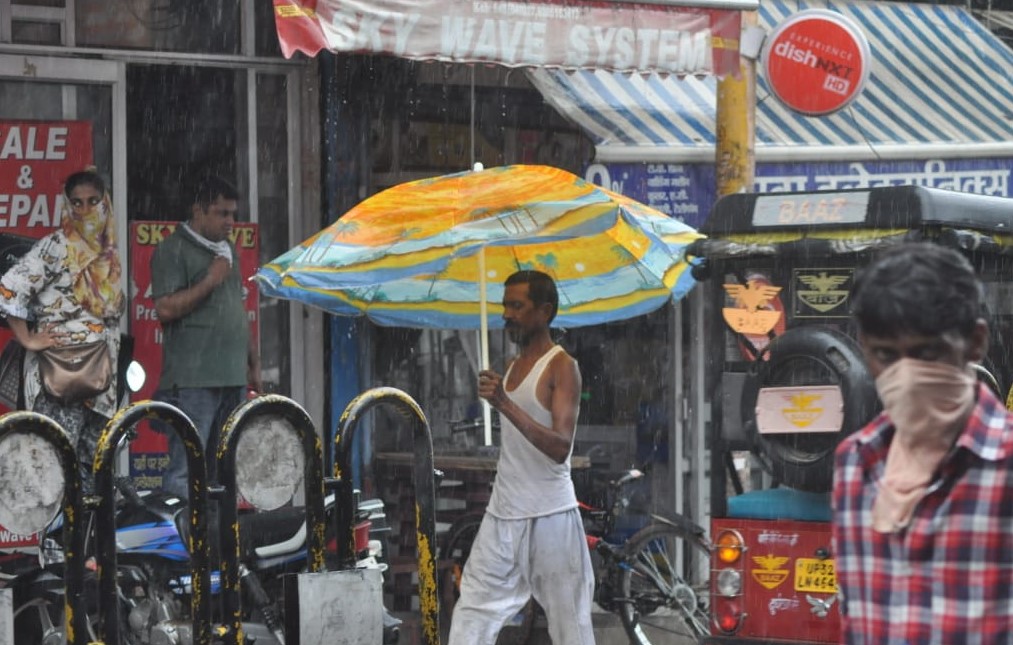
Kanpur, July 10: The monsoon trough line which had shifted from Uttar Pradesh to South India has started becoming normal again. In such a situation, the Meteorological Department told that there is a possibility of 100 mm of rain across Uttar Pradesh during the next 24 hours.
Dr SN Sunil Pandey, Meteorologist of Chandrashekhar Azad Agricultural Technology University, said on Wednesday that the monsoon trough is moving around its normal position at the surface and lower levels. This trough is showing a tendency to shift to the Gangetic plains of Uttar Pradesh, as well as there is a possibility of shifting closer to the hills. The northward shift of the trough will create small-scale cyclonic circulations along its extension parallel to the foothills of Nepal. These bubbles will cause heavy rainfall, which may lead to more than 100 mm of rain in 24 hours. There will be heavy rain in these districts
He told that the weather movement will start from the eastern border of UP. Places like Ballia, Ghazipur, Varanasi, Gorakhpur will receive moderate to heavy rainfall on July 10. The spread and intensity of rain will increase on the next day, July 11. Heavy rain will continue for a long time in Sultanpur, Amethi, Rae Bareli, Gonda, Faizabad, Prayagraj, Lucknow, Kanpur division and Bahraich. Even the south-west corner of UP may receive heavy rainfall, which includes Lalitpur, Jhansi, Agra, Aligarh and Mathura. It will also rain on July 12 and the rainfall is likely to reduce on July 13 and subsequent dates. Humid heat will also persist during this period.