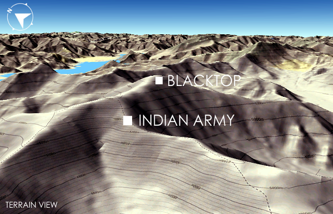
India occupies half a dozen strategic hills on the southern side of Pangong.
Military operations are under the supervision of Army Chief, CDS and NSA.
New Delhi, 20 September: The Black Top and Helmet Top mountains are not included in India’s strategic peaks on the southern side of Pangong Lake, as both of them are in Chinese territory across the LAC.
Earlier this month, India deployed the army, taking control of important hills of about 60-70 km area. Today, government sources have made it clear that India is not occupied by these peaks and the army is still about 1.5 km from there.
However, military operations are still being carried out under the supervision of National Security Advisor Ajit Doval, Chief of Defence Staff (CDS) General Bipin Rawat and Army Chief General Manoj Mukund Narwane.
In fact, on the night of August 29 and 30, about 200 Chinese soldiers tried to infiltrate the Thakung peak in Indian Territory on the southern side of Pangong Lake. They were also accompanied by tanks and ammunition, but the Indian soldiers, pre-requisite, took the lead at a time when Chinese soldiers were barely a few hundred meters away. When the Chinese troops proceeded to infiltrate, the Indian soldiers stopped them and, after a minor skirmish, pushed back considerably.
Following this recent Chinese avalanche, India launched a strategy to deploy its troops to half-a-dozen high altitudes over a 60-70 km stretch in the southern shore of the lake. India, operating ‘Operation Snow Leopard’, captured all these major peaks located on the Magar Hill, Gurung Hill, Rejang La, Rechang La, Mokhapari and Finger-4 ridge lines.
The entire operation was carried out under the supervision of Army Chief General Manoj Mukund Narwane.
While taking these peaks under control, Indian Air Force fighter jets continued to patrol around to protect the military teams. This operation was so secret that the Chinese could only get a clue after hoisting the tricolour on each peak.
After the Indian occupation of these peaks, however, there was confusion about the black top and helmet top peak. Their names also came to be counted along with the peaks that had come under the occupation of India, but today the government sources cleared the situation.
Sources also clarified that the black top and helmet top hills are in the Chinese part of the LAC, while the peaks occupied by the Indian side are on the LAC in the Indian Territory. After the Indian army captured the peaks, the Chinese army deployed about 3,000 additional troops of its joint brigade. It consists of infantry and armored troops near Rejang La, Rechang La Heights.
Firing at LAC three times in 20 days
During this time, aerial firing took place on at least three occasions from the northern shore of Pangong to the southern shore of the lake to thwart the Chinese army’s efforts. There have been three incidents of firing between India and China in the last 20 days over the border dispute in eastern Ladakh.
The first firing took place on August 29–30 when China tried to capture the Thakung Peak in the southern Pangong, and was repulsed by Indian troops.
The second time on September 7, there was firing on the peaks of Mokhapari. Chinese soldiers who came here with the intention of infiltrating had brought with them weapons, spears and sharpened tools of medieval era and they fired on the chase of India.
After this, on September 8 on the northern side of Pangong Lake, the Chinese army showed a lot of aggression, after which about 100 rounds of firing took place.


