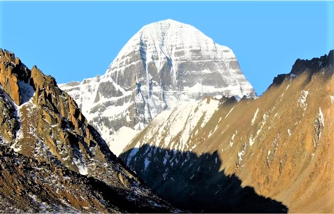
While capturing every peak, Indian soldiers chanted Har Har Mahadev.
The Chinese army to grab hills of Kailash range, tanks installed in firing range.
India also deployed a tank brigade near Rechin-la Pass to drive out the Chinese.
New Delhi, September 13: The People’s Liberation Army (PLA) has been stunned since India’s occupation of half a dozen strategic peaks such as Gurung Hill, Magar Hill, Mukherpari and Rechin-La Pass at the southern end of Pangong Lake because all these hills are Kailash Mountains range.
That is, in a way, India has taken the entire area of 60-70 km in its possession, on which China used to show eyes every time it threatened to stop the journey of Kailash Mansarovar.
While capturing these peaks of the Kailash mountain range, Indian soldiers also shouted ‘Har-har Mahadev’.
Now the Chinese army wants to grab the hills of these Kailash range at any cost, that is why China has deployed tanks in the firing range of the forward position of India.
Before the 1962 war from China, pilgrims used to go to Kailash Mansarovar from Demchok in Ladakh.
However, after the war, China illegally captured this route and closed the route of Kailash Mansarovar Yatra.
But it was reopened in 1981 with the consent of both countries. Although there are many routes to Kailash Mansarovar, including the route through Pithoragarh district of Uttarkhand via Ascot, Dharchula, Khet, Garbyang, Kalapani, Lipulekh, Khind, Taklakot is relatively smooth but this route is very long.
Apart from this, the second route goes through Sikkim and the third via Nepal route goes to Kailash Mansarovar.
In order to solve the problems faced by the Mansarovar Yatra, India prepared a fourth way which was inaugurated by Defense Minister Rajnath Singh on May 8 this year.
The Border Roads Organization (BRO) has connected the Kailash Mansarovar Marg in Uttarakhand to Lipulekh Pass at an altitude of 17,060 feet.
The Dharchula-Lipulekh route is an extension of the Pithoragarh-Tawaghat-Ghatibgarh road. It originates from Ghatibgarh and ends at Lipulekh Pass, the gateway to Kailash Mansarovar.
In this 80 km road, the height increases from 6000 feet to 17,060 feet, remaining three km near China border.
The cutting work has been left for safety. India built this link route so that the road to Lipulekh would facilitate Kailash Yatra and also provide road connectivity to the local people.
At the same time, vehicles of the Army and paramilitary forces can reach close to the China border.
The Kailash Mansarovar Yatra through Demchok, which passes through Ladakh, has been settled safely till about a decade ago, but since the feud with China started, some controversy started every year.
The distance of Demchok from the Indian region Chushul is about 150 km and the distance from Demchok to Kailash Mansarovar is about 350 km, approximately 450 km journey between Kailash Mansarovar to 450 km.
The area passes through the south of Pangong Lake where the Kailash mountain ranges like Gurung Hill, Magar Hill, Mukherpari and Rechin-La Pass are spread.
China did not allow the Kailash Mansarovar pilgrimages to pass through these Kailash mountain ranges crossing the border.
However, India had the success of taking this part of the Kailash mountain ranges under its jurisdiction on the night of August 29/30.
Before the 1962 war with China, this area was under the jurisdiction of India but after the battle of Rechin-La and Chushul during the war, the armies of both the countries went after it and the area was completely evacuated.
This is the first time since 1962 that India defeated the Chinese and captured these hills in the southern end of Pangong, where the two countries have not yet been conducting military deployments.
In fact, China opened a new front with India on the night of August 29/30 by trying to infiltrate the Thakung Peak at the southern end of Pangong Lake.
Indian troops launched a campaign to take over all the important peaks of the region after expelling the Chinese. In this sequence, within 3 days, the Indian Army has taken the entire area of about 60-70 km south of Pangong-Tso Lake and has shocked the People’s Liberation Army (PLA) of China.
Since the coming of the Kailash mountain ranges in the possession of India, China is completely dazed and tensions between two side have inclined.
Now the Chinese army wants to grab the hills of these Kailash range at any cost, that is why a large number of the PLA are gathering around the forward position of India.
Not only this, pictures of the Chinese soldiers carrying medieval weapons are getting viral on several social media platforms.
The Chinese once again tricked India into realizing that it is not right to leave these hills empty. Therefore, the forces on both sides have deployed thousands of soldiers in each other’s firing range, besides tanks, artillery guns, rocket launchers and surveillance drones.
The Indian Army has deployed its entire tank brigade close to Rechin-La Pass. Also, infantry troops have been deployed with rocket launchers and ATGMs ie anti-tank guided missiles so that if the Chinese army tries to move forward then they can be pushed back.


